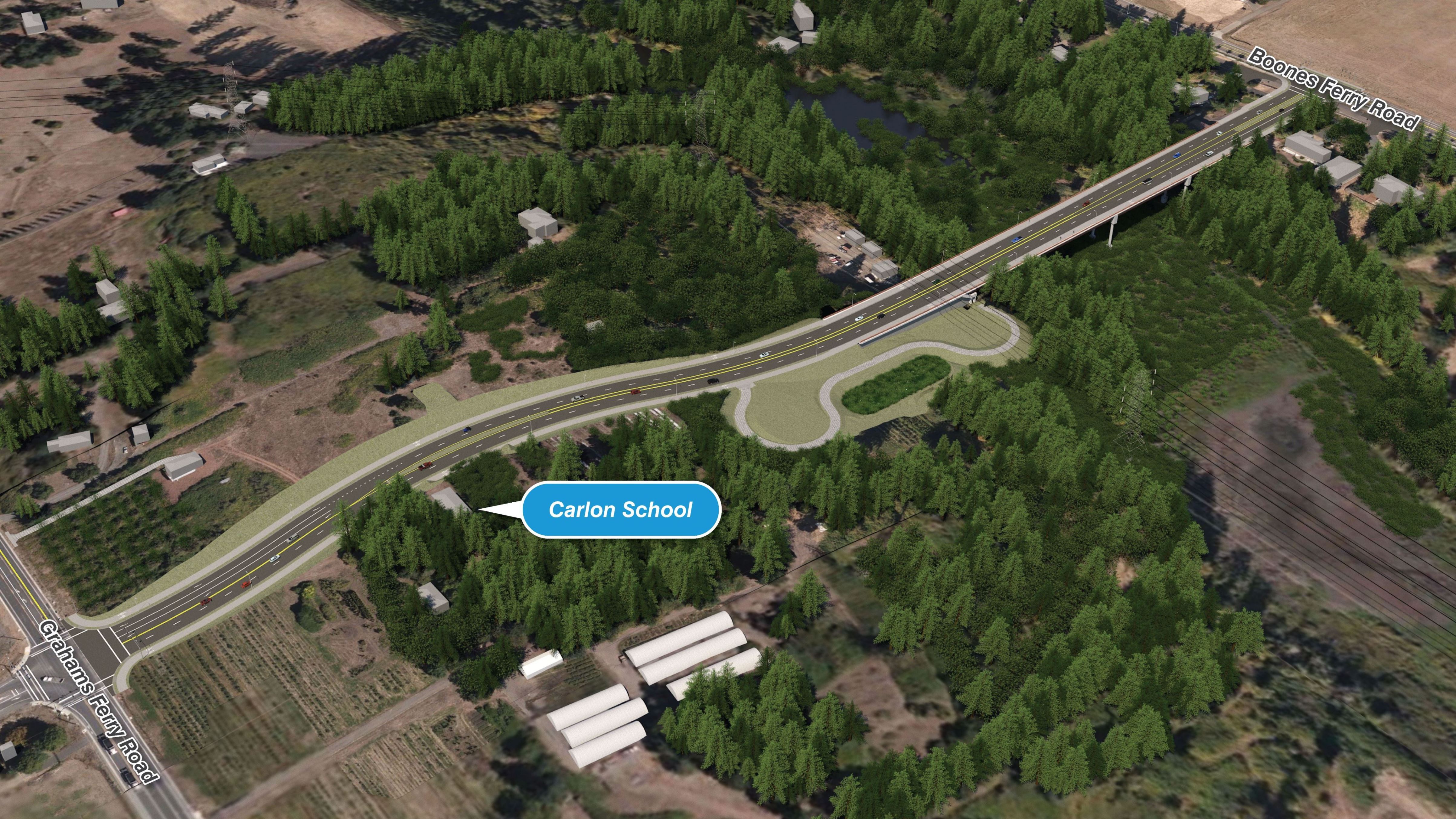
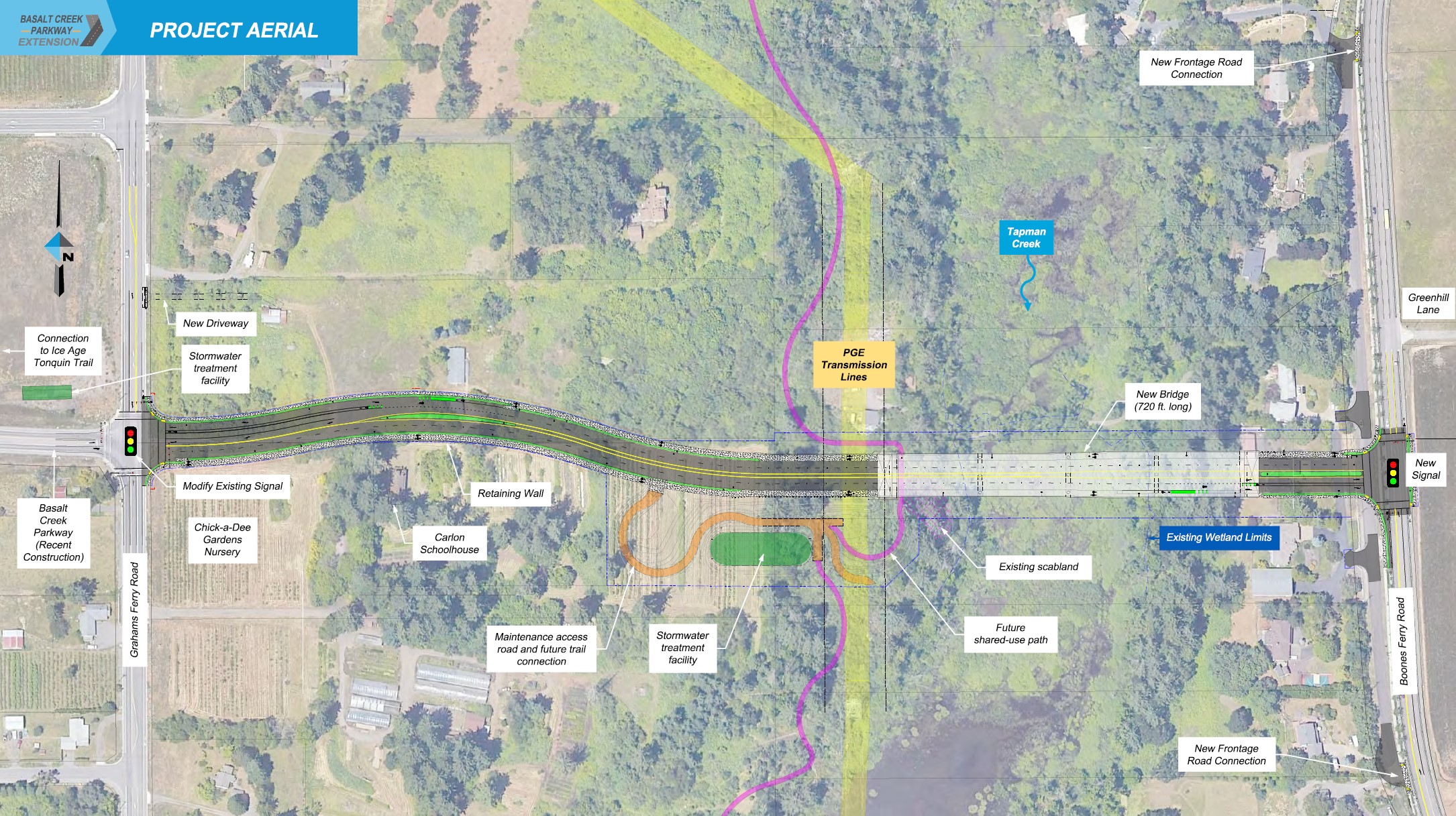
The alignment of the street avoids impacts to the Carlon Schoolhouse. A connection to a future off-street trail west of Tapman Creek is shown.
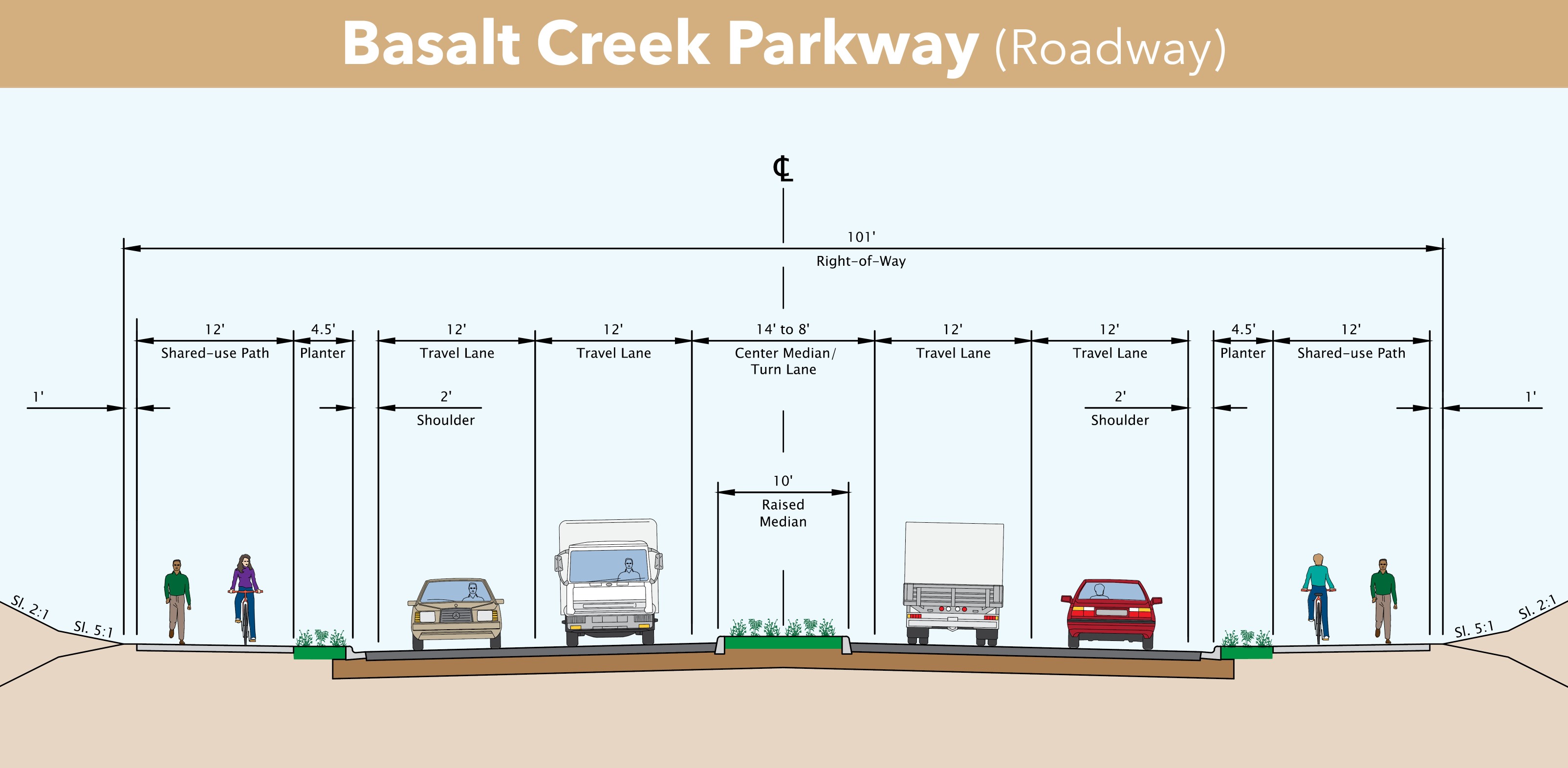
The proposed street will have two vehicle lanes and a multiuse path (bicycle and pedestrian) in each direction. A landscaped strip will separate the multiuse path from vehicles. A center turn lane or raised median will separate east and westbound vehicle traffic.
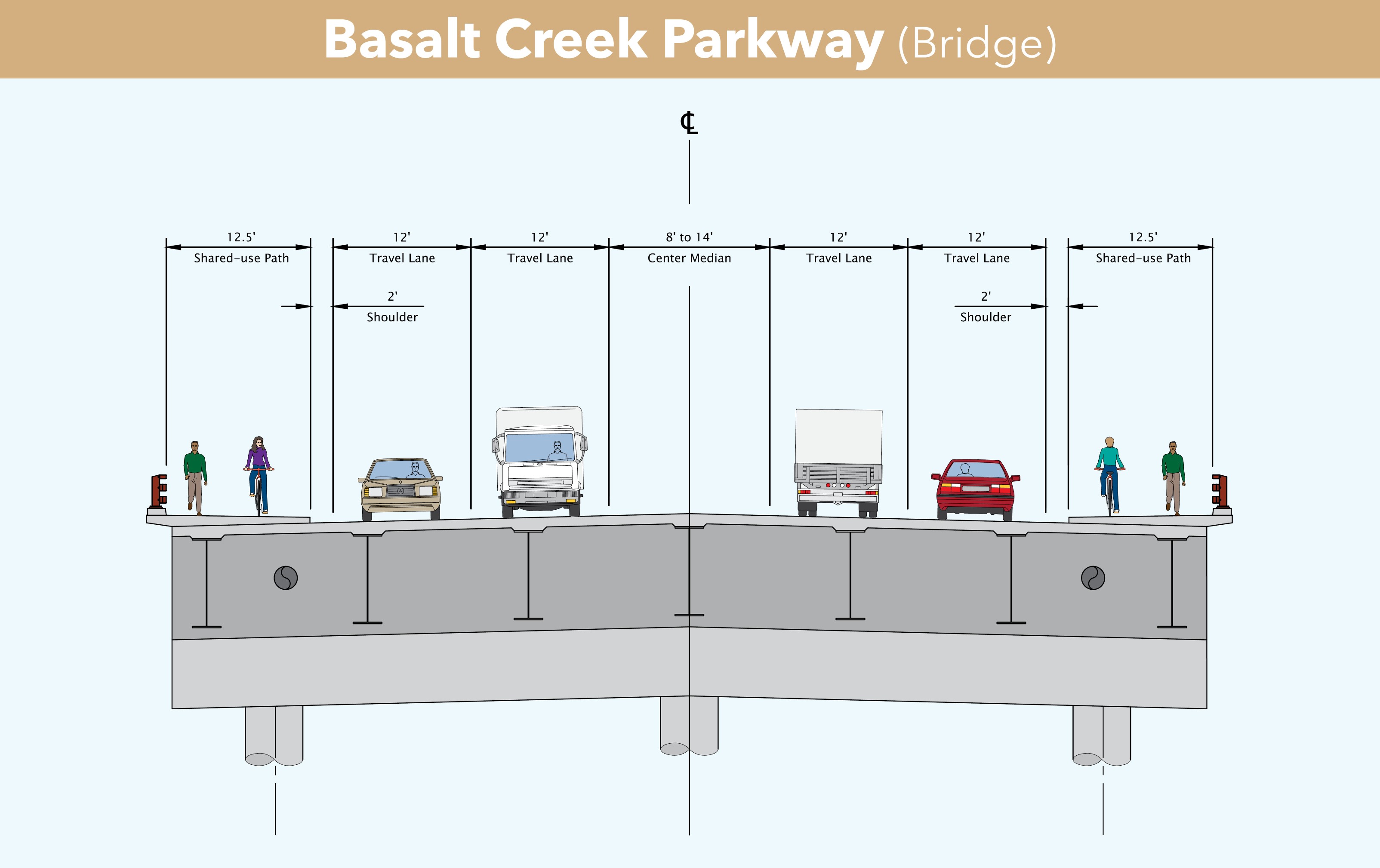
The proposed bridge spanning Tapman Creek and adjacent wetlands will have two vehicle lanes and a multiuse path in each direction. There will be no landscaping on the bridge.